


Tabula Peutingeriana app for iPhone and iPad
Developer: Gabriel Dana
First release : 16 Feb 2016
App size: 116.83 Mb
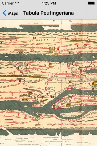
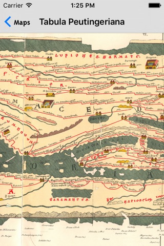
The Tabula Peutingeriana, also anglicized as Peutingers Tabula and the Peutinger Table, is an illustrated itinerarium (road map) showing the cursus publicus, the road network in the Roman Empire. It is kept at the Austrian National Library in Vienna and now is in your pocket with incredible zoom. The original map upon which it is based probably dates to the 4th or 5th century and was itself based on a map prepared by Agrippa during the reign of the emperor Augustus. The present map is a 13th-century copy and covers Europe (without Spain or the British Isles), North Africa, and parts of Asia (the Middle East, Persia, India).
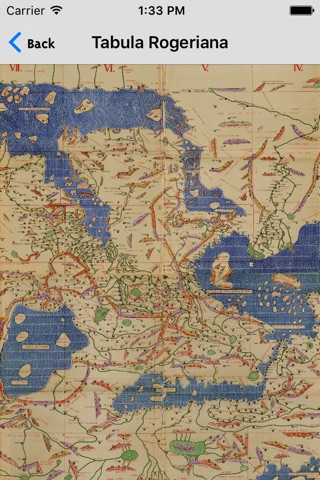
Bonus: Tabula Rogeriana (lit. "The Book of Roger" in Latin), is a description of the world and world map created by the Arab geographer, Muhammad al-Idrisi, in 1154. Al-Idrisi worked on the commentaries and illustrations of the map for fifteen years at the court of the Norman King Roger II of Sicily, who commissioned the work around 1138.